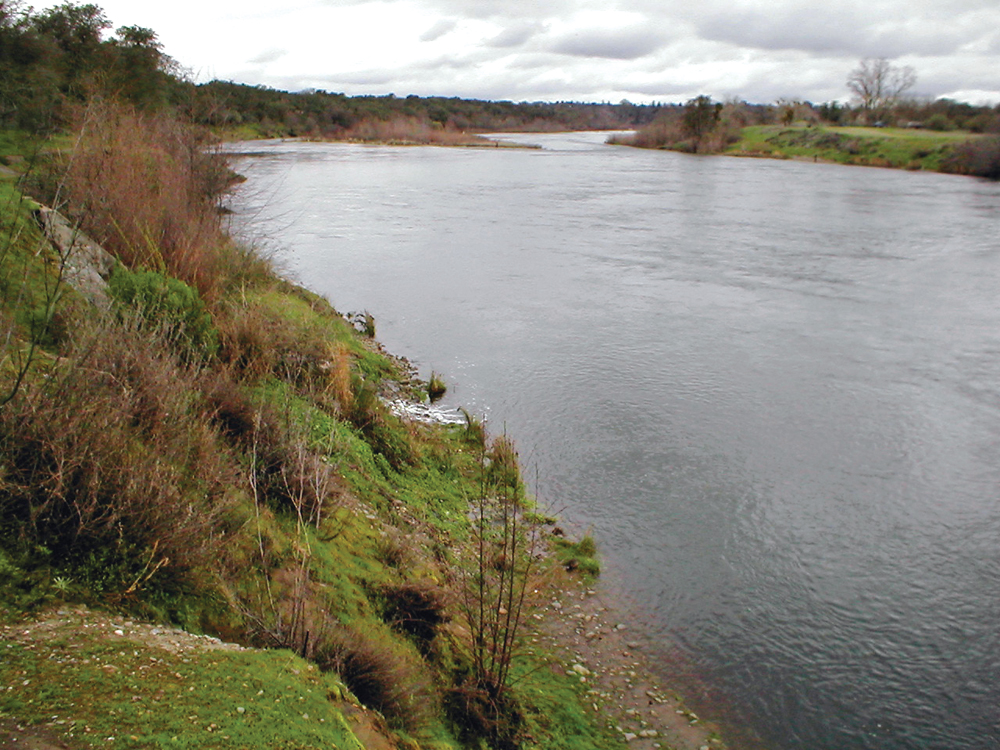
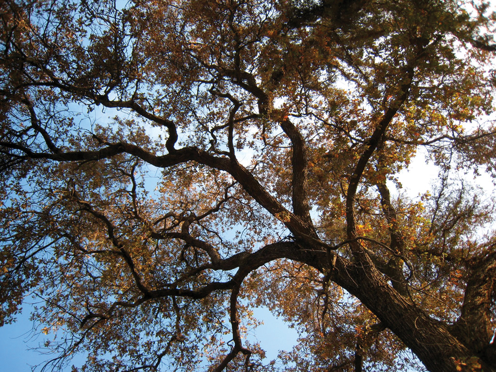
Lower American River flowing through Sacramento
Photo by Craig Miller
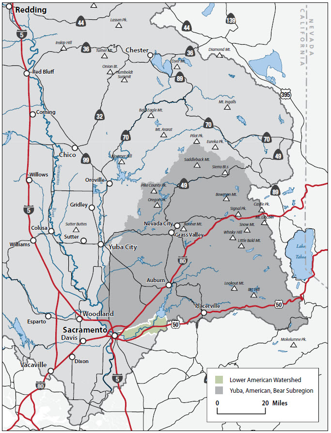
The Watershed at a Glance
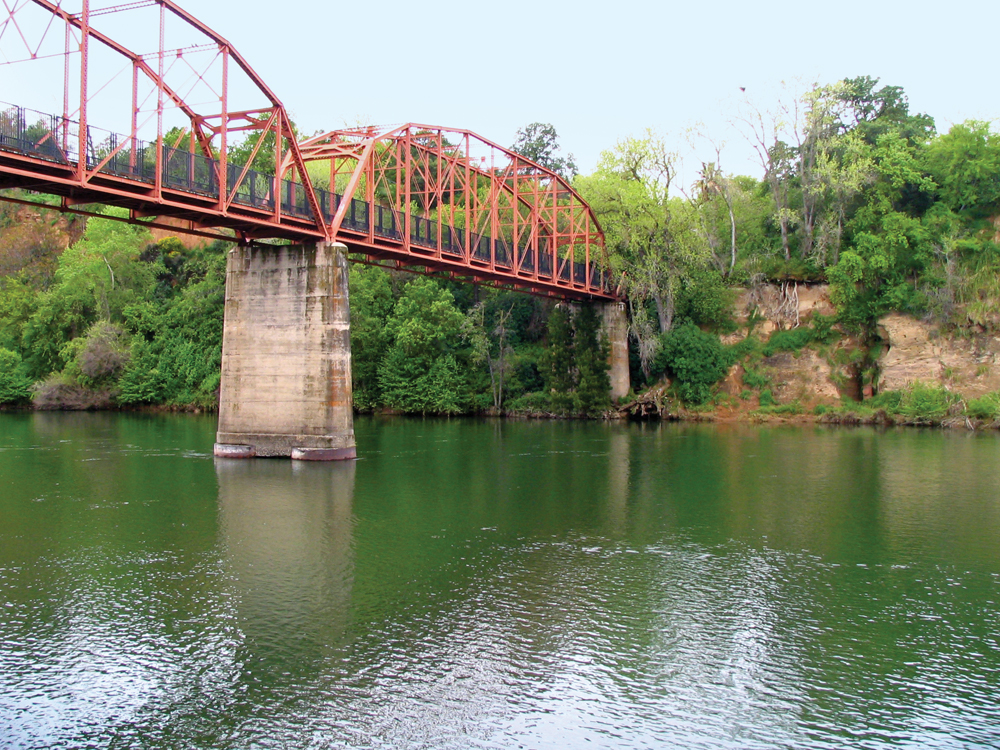
The Lower American River Watershed begins at Folsom Dam and flows 30 miles to its confluence with the Sacramento River near downtown Sacramento. Folsom Dam creates Folsom Lake, which provides flood protection for the Sacramento area; water supplies for irrigation, domestic, municipal, and industrial uses; hydropower; recreational opportunities; and maintenance of flows stipulated to protect fish and wildlife. Flows from Folsom Lake are captured by Nimbus Dam and re-regulated before flowing through the floodplain and urbanized Sacramento area. The Lower American River Watershed is valuable to the region and beyond, with more than 40 species of native and nonnative fish documented in the river, including fall-run Chinook salmon and steelhead. Although the river runs through the highly urbanized Sacramento area, the river is buffered by the 30-mile-long American River Parkway, known as Sacramento’s Jewel, which runs from Folsom to the Sacramento River confluence near Old Sacramento. Water quality is considered to be very good. The Lower American River has been designated a “Recreational River” under both the California Wild and Scenic Rivers Act and the National Wild and Scenic Rivers Act.
Hydrology
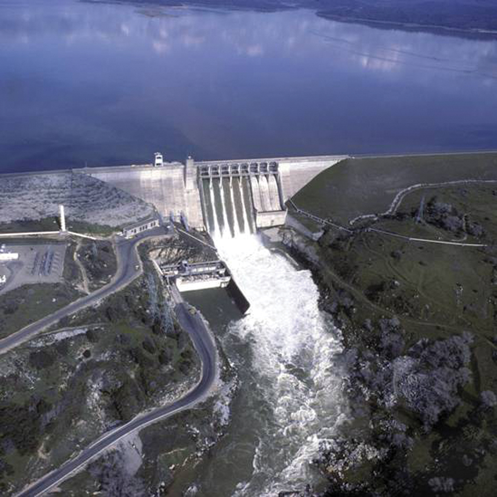
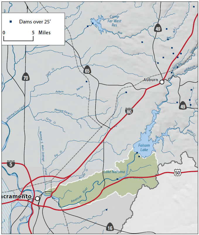
The Lower American River Watershed originates from Folsom Lake, which was created by Folsom Dam. The dam is located about 30 miles east of Sacramento and is a critical component of the Central Valley Project. Although it was it was originally authorized by Congress in 1944 as flood control unit, Folsom Dam was reauthorized in 1949 as a multipurpose facility to also store water for irrigation, domestic, municipal and industrial use, hydropower generation, recreation, water quality and maintenance of flows stipulated to protect fish. Folsom Lake features roughly 10,000 surface acres of water when full and has 75 miles of shoreline. It extends about 15 miles up the North Fork American River and about 10 ½ miles up the South Fork. During a 24-hour period, the releases of water from Folsom Dam can vary greatly to meet changing demands for water and power. Nimbus Dam, 7 miles downstream from Folsom Dam, stores these releases and re-regulates them to a steady flow downstream in the American River and allows Folsom Dam releases and power generation to fluctuate with daily power demands. Nimbus Dam forms Lake Natoma located in the town of Folsom. The Lower American River has levees on its north and south banks for about 13 miles from the Sacramento River to Carmichael on the north end. Portions of the floodplain have been acquired by either the City or County of Sacramento and is managed cooperatively as the American River Parkway.
Also included in the Lower American River Watershed are the following streams (often referred to as the American River Basin), which are located between the American and Feather River systems: Coon Creek, Markham Ravine, Auburn Ravine, Pleasant Grove Creek, Curry Creek, Dry Creek, Cordova Creek (aka Clifton’s Drain), and Arcade Creek. Most of these creeks enter the floodplain drainage systems of the Natomas Cross Canal and Natomos East Main Drainage Canal in southern Sutter and northern Sacramento Counties. The Natomas Cross Canal drains into the Sacramento River just south of the Feather River, and the Natomas East Main Drainage Canal drains into the Sacramento River just to the north of the American River.
Water Quality
American River water is generally characterized as high quality surface water that is low in alkalinity, mineral content, and organic contamination. Turbidity levels in the American River tend to be higher in the winter than summer because of higher flows associated with winter storms.
In 1991, Sacramento Regional County Sanitation District formed a partnership with the city of Sacramento and Sacramento County’s Water Resources Division to improve understanding of water quality in the Sacramento and American Rivers. Concerned about the lack of reliable scientific data about pollutants in local rivers, these agencies joined to establish the nationally recognized Sacramento Coordinated Monitoring Program. With Sacramento Regional County Sanitation District as the lead agency, this program has resulted in reliable data on more than 50 pollutants and parameters of concern for Sacramento-area surface water quality. In addition, Wastewater Treatment Plant operators throughout the region are required to monitor multiple surface water quality parameters at the sites of their discharges and downstream.
The Lower American River is listed on the Clean Water Act Section 303(d) list of impaired water bodies for mercury and unknown toxicity. Arcade Creek is listed for copper and chlorpyrifos/diazinon.
Water Forum
By the early 1990s the Sacramento region had suffered 30 years of litigious battle over the American River. Additionally, the last two California droughts brought the region water supply cutbacks and environmental degradation. Compounding these problems was a water table that had been lowered in some areas by as much as 90 feet due to over reliance on groundwater. Moreover, parts of area groundwater basins were contaminated.
Adding to water supply concerns was an increasing awareness of environmental conditions along the lower American River. With water demand growing alongside population and growing concern for the environment, leaders recognized that only negotiations involving all sides seemed the clearest solution to the area’s water woes. In 1993, the City and County of Sacramento convened the Water Forum, a diverse group of business and agricultural leaders, citizens groups, environmentalists, water managers and local governments to find solutions to the water dilemma. In 1995, water managers in Placer and El Dorado Counties joined the Water Forum. The group worked hard over a period of six years to develop a comprehensive package to address achieve two coequal objectives:
- Provide a reliable and safe water supply for the region’s economic health and planned development to the year 2030, and
- Preserve the fishery, wildlife, recreational, and aesthetic values of the lower American River.
The result is the Water Forum Agreement, signed by 40 stakeholder organizations in April 2000. The Water Forum Agreement memorized these coequal objectives by calling for implementation of the following seven elements:
- Increased surface water diversions;
- Drier year diversion reductions;
- Improved flow standard;
- Habitat management;
- Water conservation;
- Groundwater management; and
- Water Forum Successor Effort
Through funding provided by local water purveyors, The Water Forum Successor Effort has been working to implement these seven elements. In addition, the Water Forum Successor Effort has also provided an ongoing forum for resolving new water-related conflicts in the Sacramento Region.
Fish and Wildlife
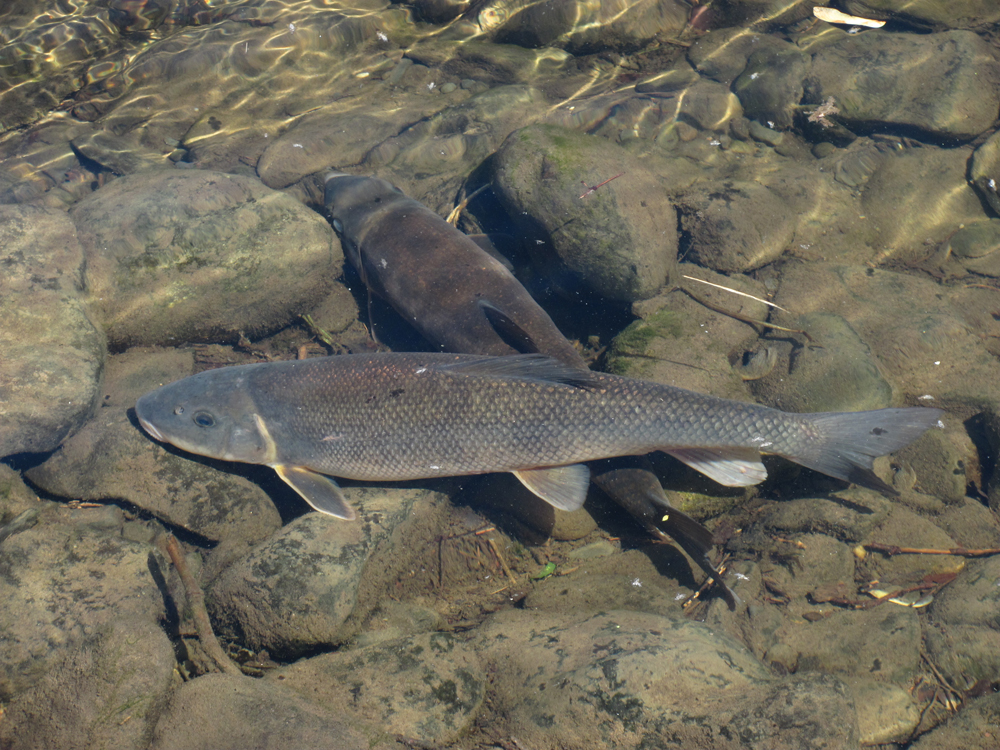
The Lower American River Watershed supports more than 40 species of native and nonnative fish, including naturally spawning fall-run Chinook salmon, steelhead, and American shad. Several of these species are of primary management concern because of their declining numbers, or their importance to recreational/commercial fisheries. Recreationally and/or commercially important species include fall-run Chinook salmon (a federal species of concern), steelhead (federally listed as a threatened species under ESA), and nonnative striped bass and American shad. Auburn Ravine in Placer County is also a critical habitat area for Chinook salmon (both spring- and fall-run) and steelhead. Wildlife frequently spotted along the river include great blue heron, egret, mallards and other waterfowl, western rattlesnake, gray squirrel, river otter, beaver, turkey, mule deer, coyote, and mountain lion.
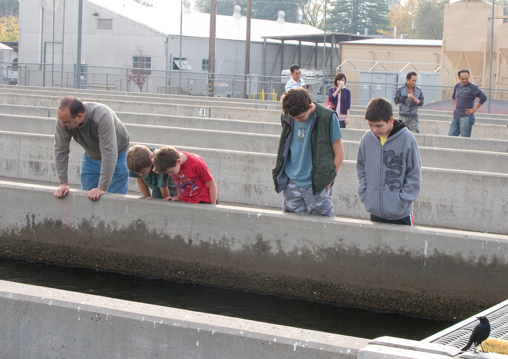

Nimbus Salmon and Steelhead Hatchery
At one time, Chinook salmon and steelhead had access to 125 miles of habitat in the upper reaches of the American River for spawning and rearing. When the Folsom- Nimbus project was completed in 1958, about 70 percent of the spawning habitat historically used by Chinook salmon and 100 percent of the spawning habitat historically used by steelhead were cut off. As a result, Nimbus Salmon and Steelhead Hatchery was constructed to replace the salmon and steelhead runs that were blocked by Nimbus and Folsom Dams. The fish weir and ladder now direct these fish to the Nimbus Fish Hatchery.
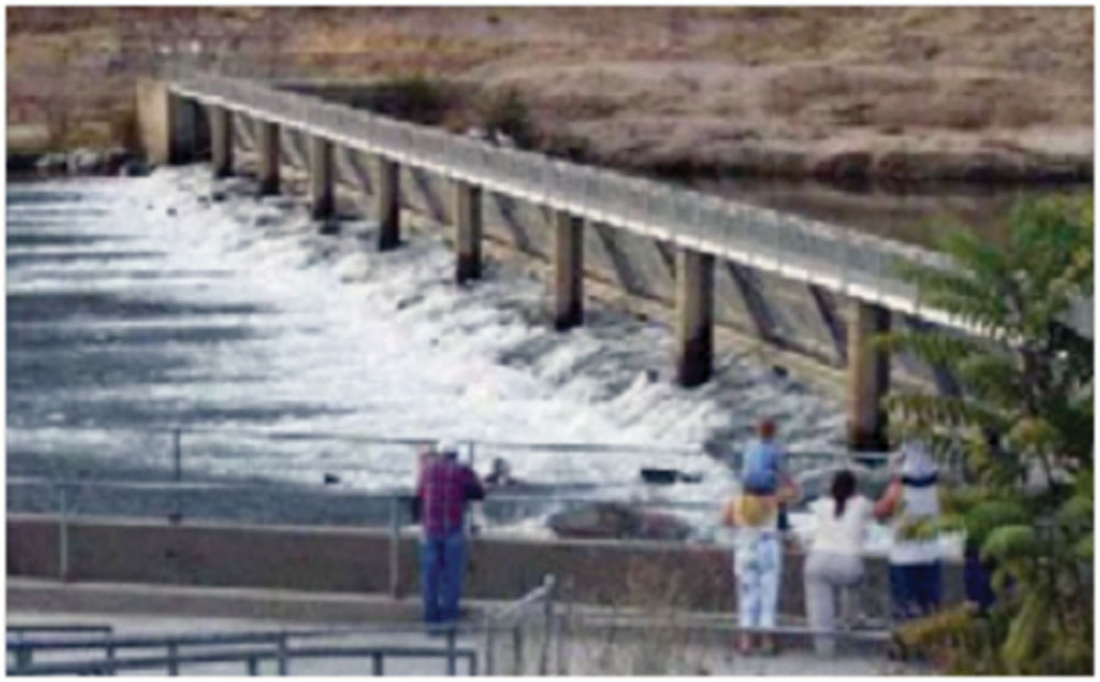
Today, a fish rack stops the upstream migration of fish because of the limited spawning area between this spot and Nimbus Dam. The rack also guides fish to the ladder entrance.
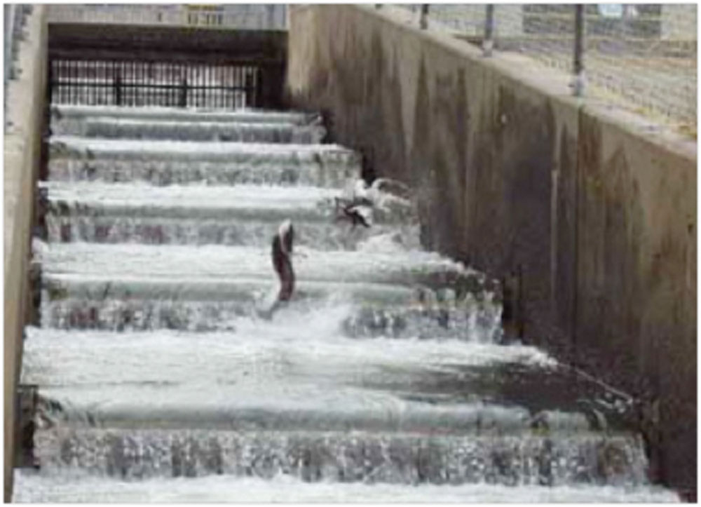
Salmon and steelhead jump over twenty steps to the top of the fish ladder. From here, they swim into the holding pond through a v-shaped weir that allows passage into the pond but not out.
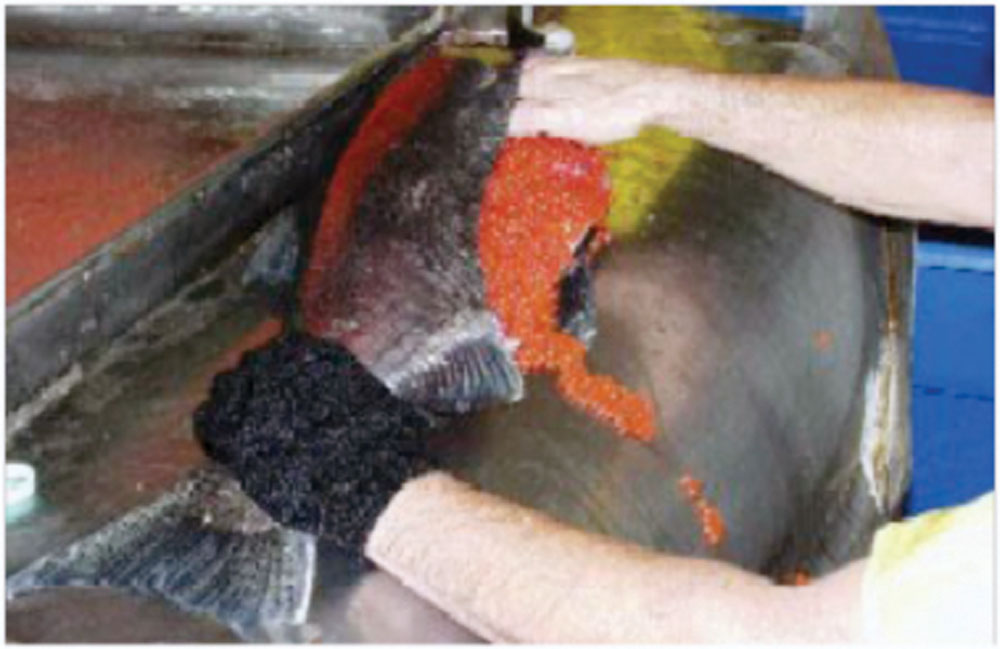
Fish are sorted and spawned on a table in the spawning building at the south end of the holding pond. In the case of salmon, fish ready for spawning are killed. Eggs are more easily and quickly taken when the body cavity is opened by an incision. (All Pacific salmon die after spawning, so killing the fish is not wasteful.)
Vegetation
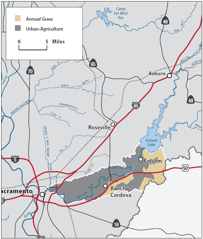
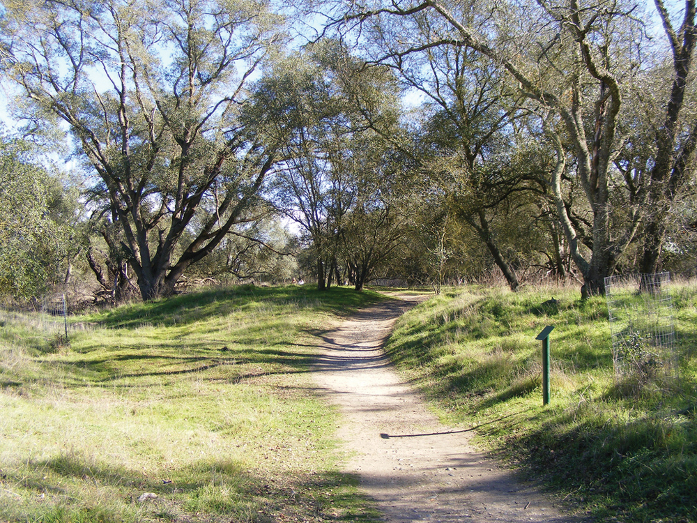
Habitat in the Lower American River Watershed represents both natural and altered landscapes. After the discovery of gold, portions of the river were dredged by the gold mining companies, leaving behind large piles of cobble and excavated areas. The slow process of natural reclamation has returned some areas to a seminatural state, while the most severely altered areas can still be seen today. The banks of the river channel provide riparian habitat—both scrub and forest consisting of cottonwood, valley oak, and willow, with occasional white alder, box elder, and Oregon ash. Understory species include wild grape, wild rose, blackberry, and elderberry. Emergent marsh habitat is found in still or slow-moving shallow water located on the edges of the river and on the banks of open water areas. These marshes are dominated by aquatic vegetation such as cattail, tule, soft rush, and blue vervain. Habitat above the riverbed consists of oak woodlands (valley and interior live oak) and grasslands (largely nonnative, but some native filaree, wild geranium, mustard, wild radish, California poppy, larkspur, and yarrow). The area outside of the American River Parkway is highly urbanized.
Habitat in the American River Basin was historically a large wetland area. Today the floodplain is principally rice fields in the north and central areas, with the metropolitan area of Sacramento to the south. Above the floodplain the creeks pass through the rolling hills of Placer County, and cities of Lincoln, Roseville, and Rocklin. This area is a mixture of agricultural lands, grasslands, oak woodlands, and urban development.
Life in the Watershed
The Lower American River headwaters are located in the town of Folsom (population 72,590) and flow westward through the communities of Orangevale, Fair Oaks, Carmichael, and into the city of Sacramento (population 486,289). The watershed is highly urbanized and relies on a network of levees to protect the area from flooding.
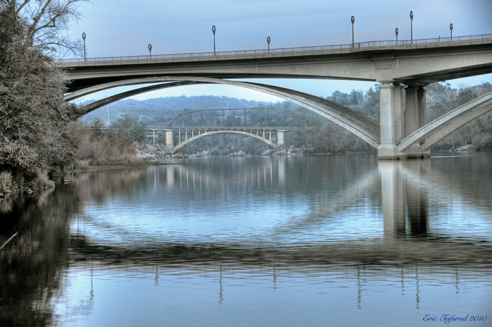
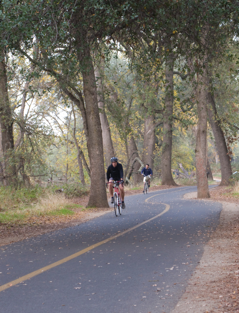
Bordering both sides of the Lower American River is the American River Parkway Trail, a 30-mile paved bicycle and trail network that provides a greenbelt area from Nimbus Dam to the confluence of the Sacramento River. Folsom Lake and Lake Natoma also provide a plethora of recreation opportunities. The Effie Yeaw Nature Center, an environmental and cultural education center, is located along with the American River Parkway. The area is rich in history and culture from Native American artifacts, early European settlements, to gold rush era reminders. Major employers in the watershed include Intel in Folsom and hospitals, state government, Sacramento Municipal Utility District and California State University, Sacramento.

Management Objectives
An IRWM Plan for the Lower American, Lower Sacramento, and Lower Consumnes Rivers was completed in June 2006. Management objectives from the plan are summarized as:
- enhance drinking water supply availability and reliability;
- develop strategies to ensure 200-year flood protection through a collaborative, watershedwide approach;
- minimize impacts from stormwater discharges to receiving water quality in sensitive river systems using BMPs and watershed management activities;
- improve groundwater management;
- lead a region-wide effort to preserve the environmental health and well-being of the region by identifying opportunities to restore and enhance the natural resources of streams and watersheds; and
- identify potential opportunities for expanding recycled water use in urban and agricultural areas and industrial applications.
Management Organizations Active in the Watershed
The Lower American River has 21 governmental agencies responsible for managing natural resources, land use, recreation, water supply, and flood control in the river corridor. In addition to government agencies, the following organizations are also active in addressing local watershed issues.
Regional Water Authority
The Regional Water Authority is a joint powers authority formed as a policy forum to serve and represent the regional water supply interests and to assist members in protecting and enhancing the reliability, availability, affordability, and quality of water resources. One of the principal missions of the Regional Water Authority is facilitating implementation of the conjunctive use program prescribed by the Water Forum Agreement north of the American River. The Regional Water Authority has 19 members and three associate members, encompassing water users from Sacramento, Placer, El Dorado, and Yolo Counties. The Regional Water Authority is leading the effort to update the existing American River Basin IRWM Plan.
Sacramento Area Flood Control Agency
SAFCA was formed in 1989 to address the Sacramento area’s vulnerability to catastrophic flooding. This vulnerability was exposed during the record flood of 1986 when Folsom Dam exceeded its normal flood control storage capacity and several area levees nearly collapsed under the strain of the storm. In response, the City of Sacramento, the County of Sacramento, the County of Sutter, the American River Flood Control District, and Reclamation District 1000 created SAFCA through a Joint Exercise of Powers Agreement to provide the Sacramento region with increased flood protection along the American and Sacramento Rivers. SAFCA is an active participant in the American River Basin IRWM Plan.
American River Parkway Foundation
The mission of the American River Parkway Foundation is to foster environmental stewardship, facilitate volunteer opportunities, and fund projects and programs on the American River Parkway that support the preservation, protection, enhancement, and appreciation of the parkway natural resources.
American Basin Council of Watersheds
In 2005, three separate organizations with interests in the watersheds of western Placer County—Dry Creek Watershed Council, Auburn Ravine/Coon Creek Watershed Group, and Pleasant Grove/Curry Creek Watershed Group—folded their activities into the American Basin Council of Watersheds ABCW). The Council is participating in both the CABY and American River Basin IRWM planning processes. The American River Basic Collaborative is the successor organization to ABCW.
Water Forum
The Water Forum has been working cooperatively in the last ten years with local, state and federal agencies to enhance the and restore habitat in the lower American River.