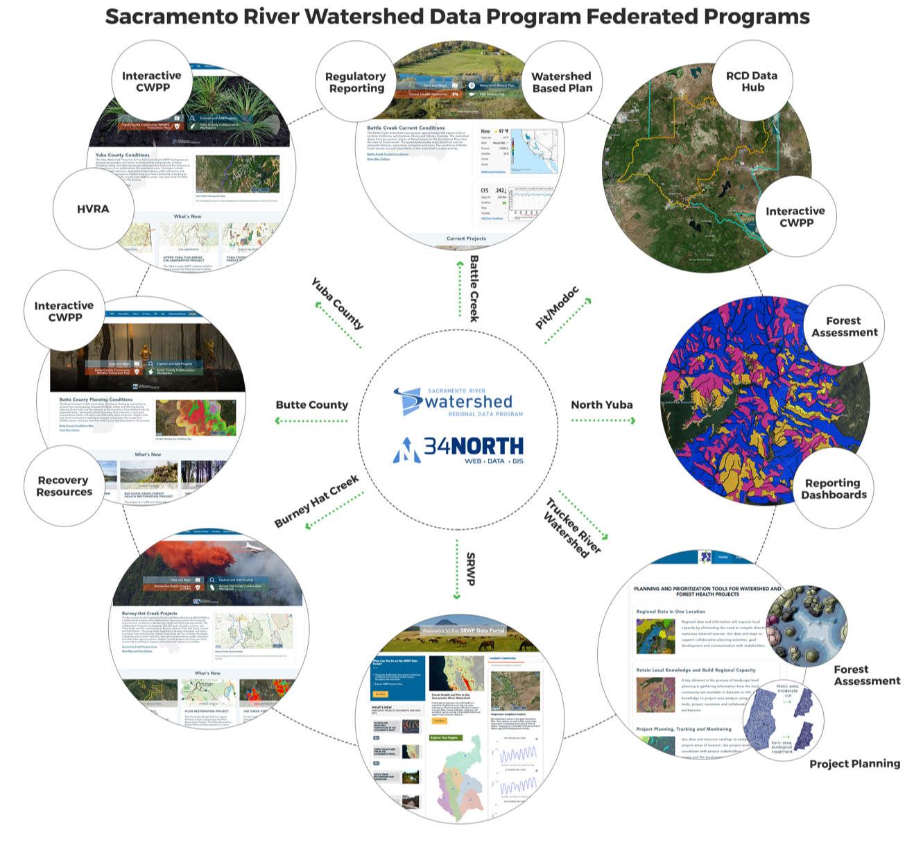
The Sacramento River Watershed Data Program (SRWDP) is a collaborative effort to support restoration and management activities throughout the Sacramento River Watershed. This effort is led by the SRWP and 34 North. SRWP brings together dozens of groups and thousands of people concerned about the health of the Sacramento River and its watershed. With a proven track record of success, SRWP operates through consensus-based collaborative partnerships, coordination of research and monitoring, and enhancing mutual education among the stakeholders of the Sacramento River Watershed.
34 North is an innovator in collaborative natural resource management technologies and data solutions. They are experts in web and mobile technologies, GIS, data management (including open data initiatives), analytics and visualizations.
Together, 34 North and SRWP have developed a powerful data program that will increase the pace and scale of restoration across the Sacramento Watershed.
Features
Building Organizational Capacity. SRWP works with the region's stakeholders to increase capacity by providing data management support, strategic partnership development, project management, and program and funding development.
Regional Data Platform. The SRWDP engages stakeholders on a web-based platform to gather information about priorities, project locations and more. It builds on the regional and statewide portals developed for managing data for other instances and establishes the foundation to link regional, state and federal priorities. Sharing data across all regions encourages strategic prioritization of projects, reduces redundancy, and advances watershed management efforts.
Regional Data. The SRWDP aggregates, organizes and displays essential geospatial and monitoring datasets for the region including water quality, fisheries, forest health, land use, and water operations data in a comprehensive data portal.
Intuitive and Interactive Data Tools and Applications. Data analysis and visualization tools transform data into information for decision support.
Linking Landscape Level Assessment and Planning with Watershed Planning. By improving data access, the SRWDP is developing tools to better link landscape level planning with watershed planning. The efforts are taking shape within critical areas in the watershed and will be made available to all stakeholders.
Community Outreach and Education. The SRWDP gathers and shares data and information from hundreds of regional stakeholders so that we can mutually benefit and learn from each other's efforts. Stakeholders can aggregate information and data to develop stories and convey key messages to foster understanding and information sharing within the region and support timely and science-based decision-making.
Collaboration and Transparency. Open access to data and tools supports collaborative project development across the watershed.
Our Program Partner: 34 North
 Forest restoration and management must be implemented strategically at the landscape scale to effectively yield multiple watershed benefits. Working with 34 North and the OpenNRM data platform we are strategically building tools to support fuels reduction and forest restoration planning. The platform facilitates a more robust collaborative planning process and addresses the challenges facing our forests and the need to increase the “pace and scale of restoration.”

