Upper American
Photo by Stacy Lynn Baum
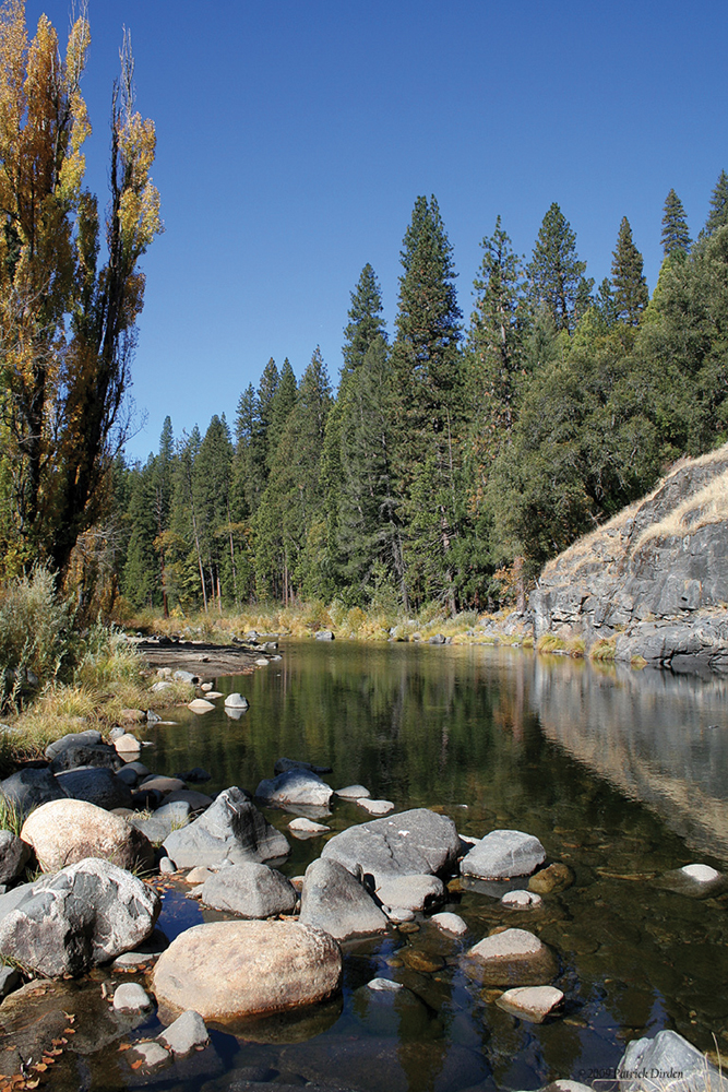
The Watershed at a Glance
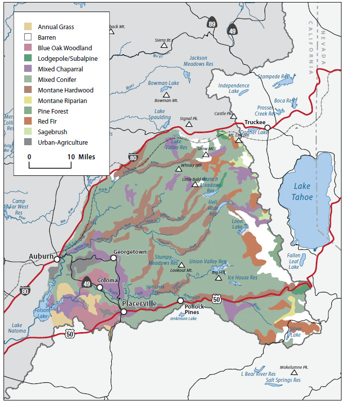
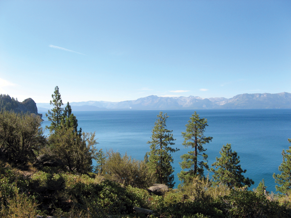
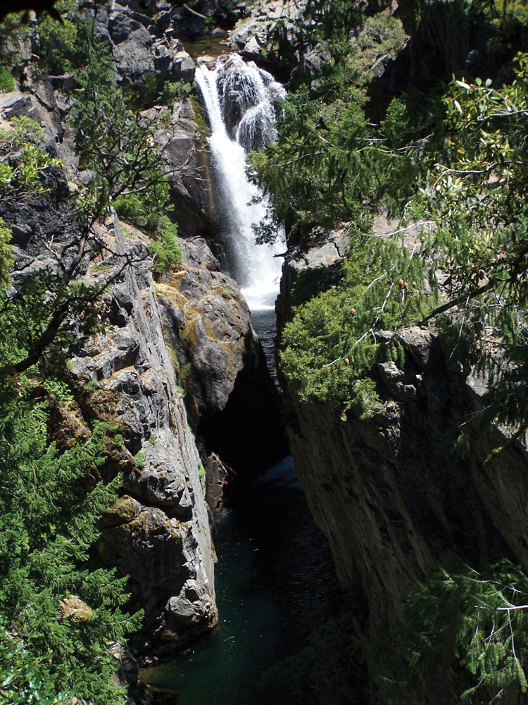
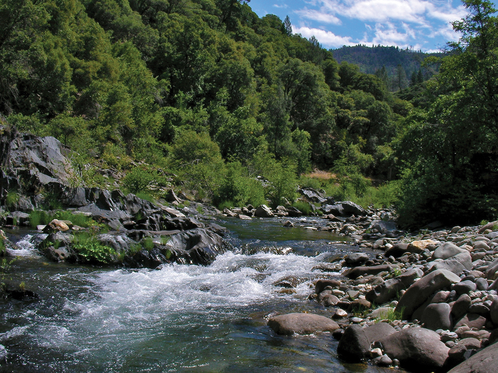
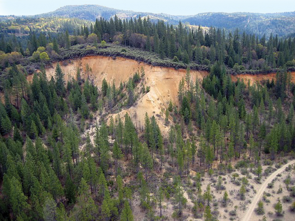
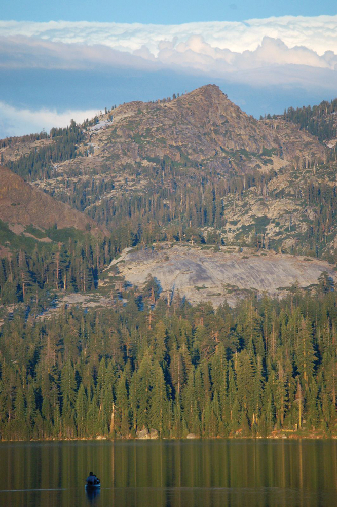
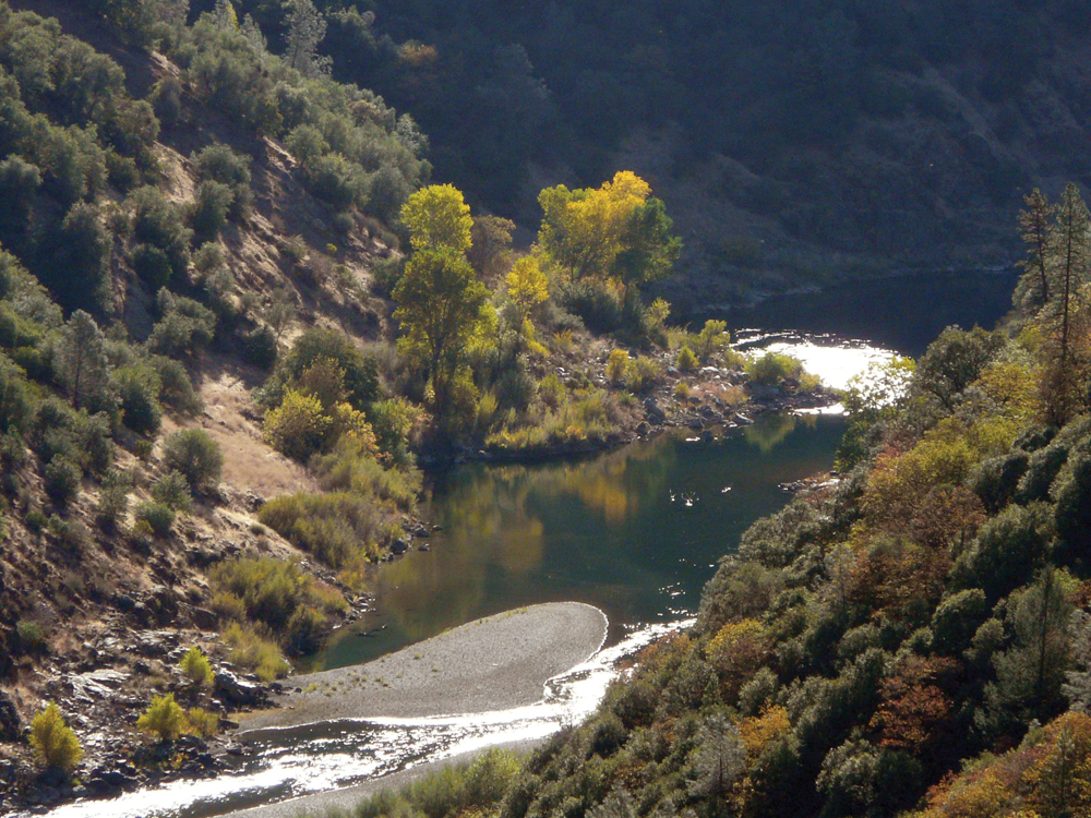
The Upper American River Watershed originates at the crest of the Sierra Nevada near Lake Tahoe. The upper watershed has three forks: the North, Middle, and South Fork; all three forks are known for their verdant canyons, forested ridges, massive rock formations, trails, backcountry winter adventuring, fishing, and white water rafting. Like most major western U.S. rivers, the American River has been extensively dammed and diverted for hydroelectricity production. There are 5 power plants on the Middle Fork and 11 on the South Fork. Vegetation in the upper watershed consists mostly of mixed conifer and montane hardwood transitioning to oak woodland as the elevation decreases. Gold was discovered in the upper watershed in 1848, leading to the California Gold Rush. Reminders of the gold rush era continue to play a big part of the watershed today. Water quality in the Upper American is considered very good, although the South Fork is listed on the Clean Water Act Section 303(d) list for mercury. National Wild and Scenic River status has been proposed for reaches of the North and Middle Forks.
Hydrology
The American River Watershed originates at the crest of the Sierra Nevada just west of Lake Tahoe, within Tahoe and El Dorado National Forest boundaries. The American River has three forks: the North, Middle, and south. Major streams in the watershed are the Rubicon River, Duncan Creek, Long Canyon Creek, and Silver Creek. The main reservoirs and lakes in the watershed are: French Meadows, Hell Hole, Union Valley, Ice House, Lake Valley, Loon Lake, Silver Lake, Slab Creek, and Stumpy Meadows.
North Fork
The North Fork American River is 287 square miles, 85 miles long, and originates in eastern Placer County in the Tahoe National Forest. It flows west and then southwest, passing the town of Colfax and through Clementine/North Fort Reservoir; it receives the Middle Fork American 4 miles below the North Fork Reservoir Dam near the town of Auburn and meanders past the site of the abandoned Auburn Dam. A portion of the North Fork American River is designated a National Wild and Scenic River.
Middle Fork
The Middle Fork American River is 312 square miles and 65 miles long. It flows west-southwest from its headwaters through French Meadow Reservoir and receives the Rubicon River, a designated Wild Trout Stream (from confluence with Middle Fork, American River upstream to Hell Hole Reservoir) before flowing into the North Fork American River just northeast of the city of Auburn. Twenty-three miles of the Middle Fork American are eligible for National Wild and Scenic River status. Placer County Water Agency owns five hydroelectric plants on the Middle Fork American River.
South Fork
The South Fork American River is 850 square miles, 90 miles long, and originates in the high Sierra in the El Dorado National Forest. The river flows west, receiving Silver Creek, a major tributary, and flows past the town of Coloma where it then turns southwest, receiving Weber Creek before entering Folsom Reservoir. There are 11 hydroelectric plants on the South Fork—Sacramento Municipal Utility District operates eight hydroelectric plants, and El Dorado Irrigation District, PG&E, and Rock Creek Powerhouse each operate one.
Water Quality
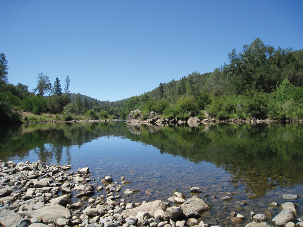
In general, water quality in the American River is considered to be very good from headwaters to the confluence with the Sacramento River. Streams in the upper watershed are typically clear, cold streams that are naturally highly oxygenated, low in dissolved ions and nutrients, and exhibit low instream plant or algal growth. However, erosion from land use activities (past and present), roads, and recreational use throughout the watershed contribute to instream sediment problems. The South Fork American River is listed on the Clean Water Act Section 303(d) list of impaired water bodies for mercury because of historical mining activities.
Fish and Wildlife
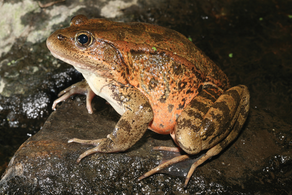
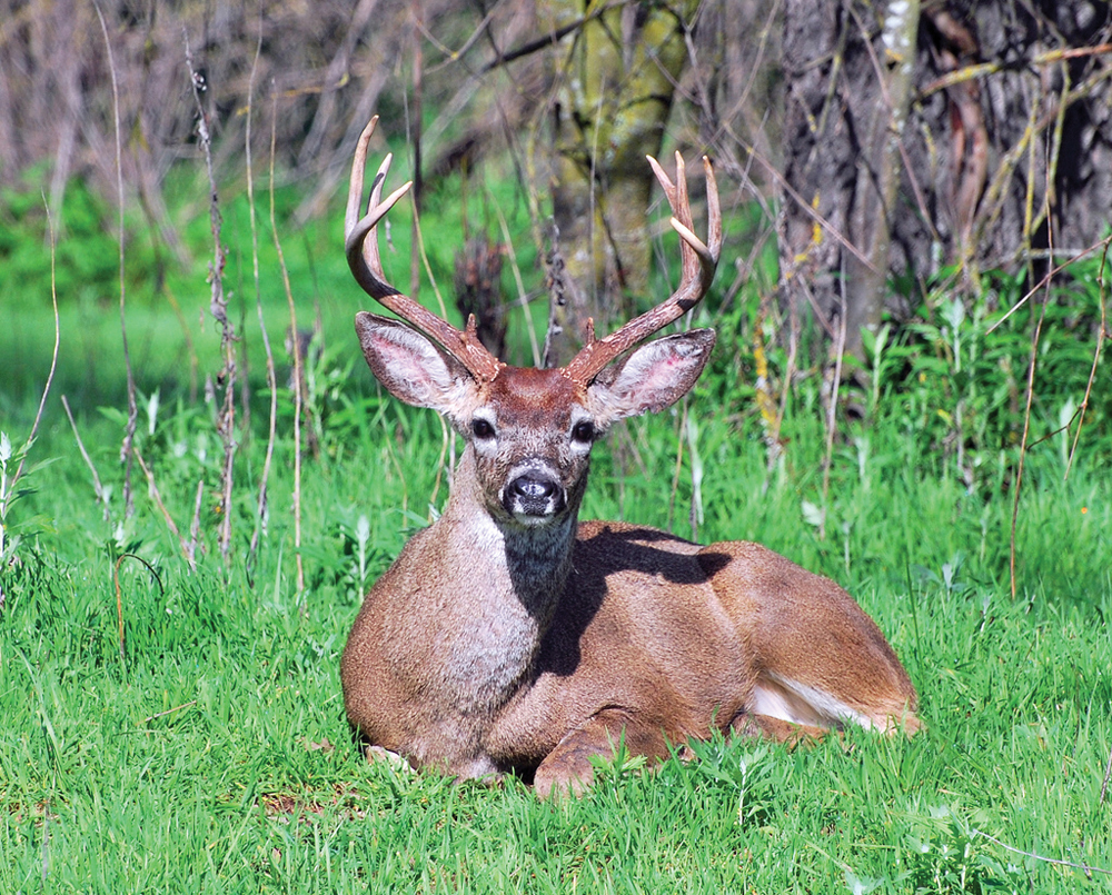
The Upper American River Watershed supports a wide variety of wildlife. Typical bird and mammal species include mountain quail, mourning dove, Steller’s jay, western bluebird, warblers, squirrels, skunk, chipmunk, grey squirrel, coyote, mule deer, black bear, and mountain lion. Endangered species in the watershed include the American bald eagle, California red-legged frog, and valley elderberry longhorn beetle. With few exceptions, the high mountain lakes above 6,000 feet were historically fishless—dominated instead by amphibians, insects, and small aquatic invertebrates. It has been only within the last few decades that fish were introduced into the higher elevation lakes. The upper watershed streams provide high quality habitat for native fish, including trophy-sized rainbow trout. Anadromous fish species are found in the Lower American River, but do not have access past Nimbus Dam.
Vegetation
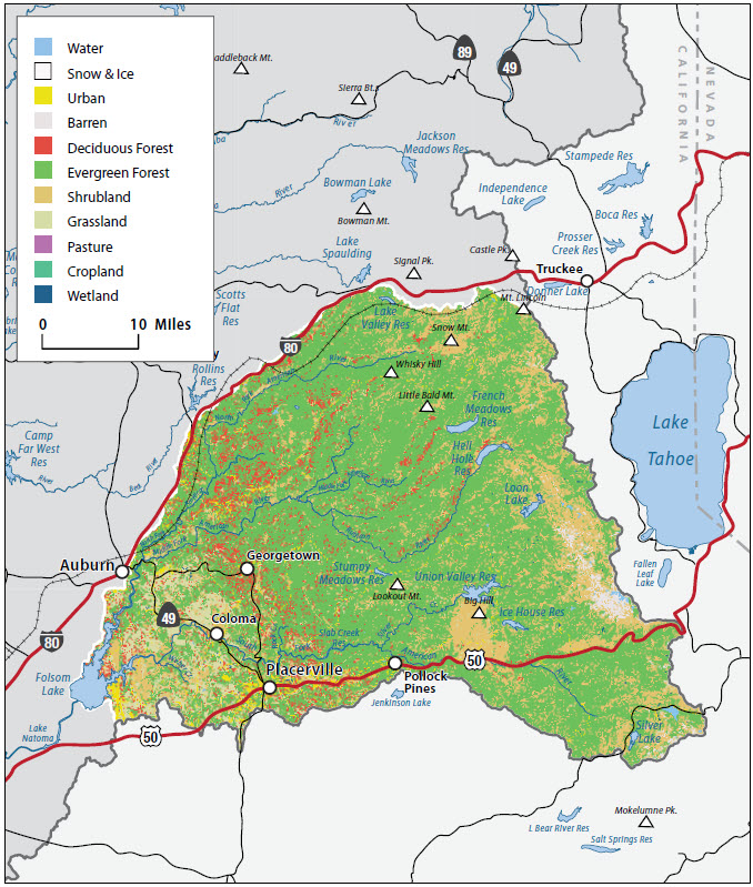
The majority of the channels in the watershed have moderately steep gradients and are confined by narrow V-shaped valleys. The watershed has been influenced by natural events such as fire, floods, and fluctuating flows, and activities such as mining, grazing, timber management, and recreation. The watershed supports a diversity of habitat and vegetation types. The higher elevations consist of mixed conifers and montane hardwoods, while the lower elevations include grasslands, oak woodland, chaparral, and mixed conifers. Historically, fire has played an important role in maintaining a diverse landscape; however, accumulated fuels resulting from land management practices, along with residential development in forested area, have increased the risk of catastrophic fire in many parts of the region.
Life in the Watershed
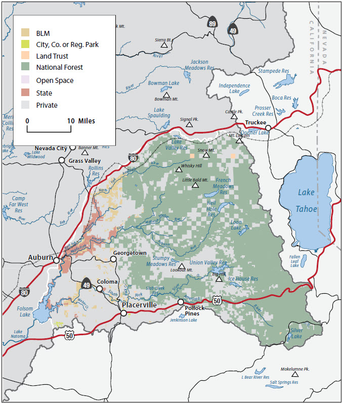
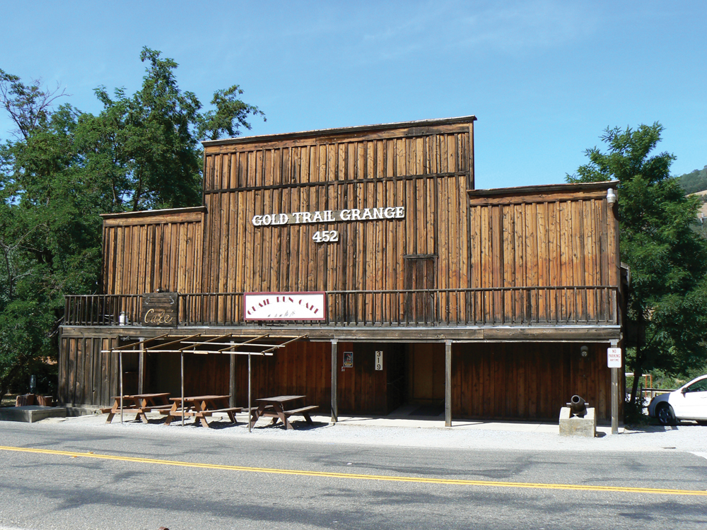
Approximately 85% of the canyons in the upper watershed are federally owned public lands. The upper watershed canyons are dotted with more than 1,500 historical gold rush era and Native American cultural sites, many of which are eligible for inclusion on the National Register of Historic Places. The main communities in the lower watershed are Placerville, Auburn, Foresthill, and El Dorado Hills. An increase in the population over the past decade can be attributed to an increase in professional services, industries, and residential development.
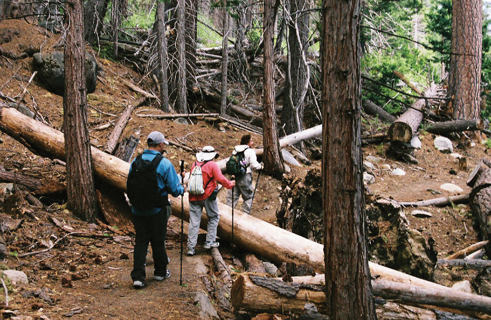
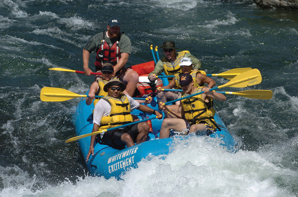
The watershed is heavily used for recreation. The rivers offer a wide variety of whitewater recreation opportunities, including Class IV and V whitewater adventures. More than 100 miles of trails provide access for hikers, anglers, and other recreationists. Winter months provide skiing and snowmobiling opportunities. The Middle Fork is used extensively for both motorized and non-motorized recreation, including fishing, whitewater adventuring, bicycling (mountain and road), horseback riding, trail running, and hiking. It contains areas used for hydroelectric generation, mining, and agricultural timber cultivation and harvesting. The Middle Fork features the Western States Trail, which hosts multiple annual endurance events, including the prestigious Tevis Cup equestrian trail ride and the world-famous Western States 100- Mile Trail Run, both beginning at Squaw Valley and leading to Auburn via remote wilderness trails. The South Fork also has multi-use recreation areas, including the Rubicon Trail for motorized adventuring and whitewater rafting. The South Fork also features Coloma, the site where gold was discovered in California in 1848. Recreational gold panning is a popular family activity.
Management Objectives
An IRWM Plan for the Cosumnes, American, Bear, and Yuba Rivers was adopted in December 2006. The plan was developed by a diverse group of stakeholders throughout the region and includes a number of goals and objectives for the four watersheds summarized as:
- achieve sustainable surface and groundwater supply;
- provide multiple benefits from management of water resources, diversions, and infrastructure;
- reduce impacts from catastrophic fire;
- protect infrastructure, equipment, and property from flooding;
- protect and improve watershed resources through land use practices;
- manage sediment for water quality and habitat value;
- reduce mercury contamination in waterways;
- reduce contamination of surface and groundwater resources; and
- protect and improve fisheries and aquatic biota through water resources management.
Management Organizations Active in the Watershed
CABY
CABY is a collaborative planning effort that adopted an IRWM Plan in December 2006 in response to the passage of Proposition 50. The CABY region includes the Cosumnes, American, Bear, and Yuba Rivers. CABY comprises more than 30 organizations, representing water supply, conservation, recreation, agriculture, and community interests, as well as federal and local government. CABY is pursuing a planning grant through the IRWM Program in order to update their Plan.
Placer County RCD
The Placer County RCD was organized in 1946 and is dedicated to the conservation of natural resources in the county. The RCD develops and enables programs in partnership with others that assist private landowners and public agencies to accomplish the goal of conserving natural resources. The RCD is working with the CABY IRWM effort.
American Basin Council of Watersheds
In 2005, three separate organizations with interests in the watersheds of western Placer County—Dry Creek Watershed Council, Auburn Ravine/Coon Creek Watershed Group, and Pleasant Grove/Curry Creek Watershed Group—folded their activities into the American Basin Council of Watersheds. The group is participating in the CABY IRWM effort.