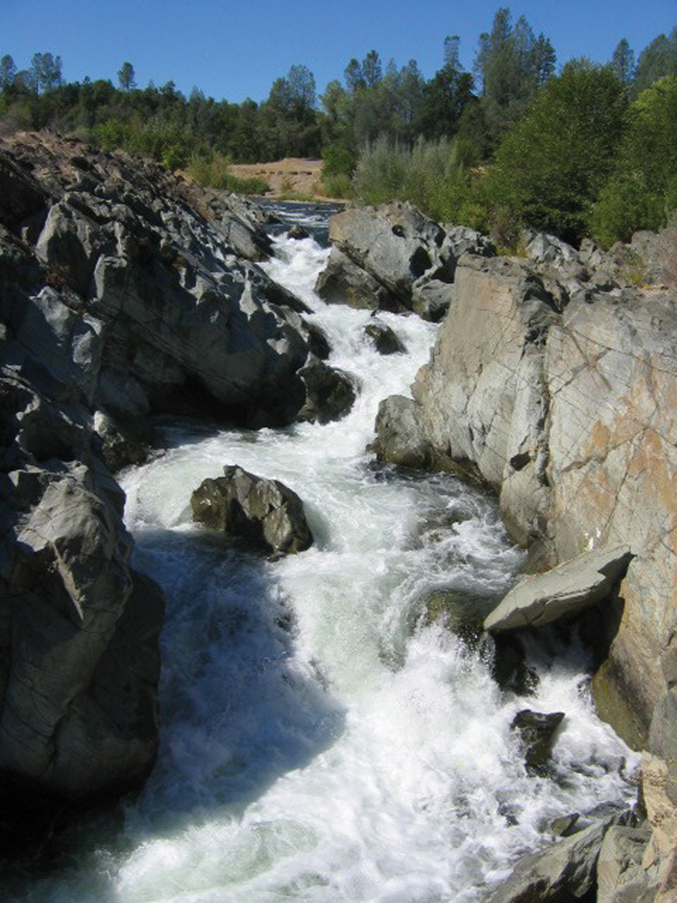
Lower Clear Creek Gorge
The Watershed at a Glance
The Clear Creek Watershed begins in the Trinity Mountains east of Trinity Lake and flows approximately 50 miles to its confluence with the Sacramento River just south of the Redding city limits. The watershed is divided into Upper Clear Creek and Lower Clear Creek, with Whiskeytown Reservoir forming the boundary. With controlled release of cold water from Whiskeytown Dam, Lower Clear Creek is one of the principal streams in the Sacramento River Basin for salmon spawning and rearing. In recent years, CALFED and its member agencies, and the Western Shasta RCD have invested heavily in restoration work to enhance anadromous fish populations, while at the same time, the BLM has aggressively pursued acquisition of private lands in Lower Clear Creek to expand public access and recreation opportunities. Management issues in this watershed focus on forest health and fire management in Upper Clear Creek and maximizing anadromous fish populations in Lower Clear Creek.
Hydrology
Streamflow in the upper watershed is characteristic of the Mediterranean climate of northern California, with high flows during wet winter months and lower flows during summer and fall. Flow gaging was maintained at a site near the town of French Gulch from 1950 to 1993. Mean monthly discharge was approximately 600 cfs with a peak discharge of 14,600 cfs (January 1974) and a minimum of 1.5 cfs (July 1977).
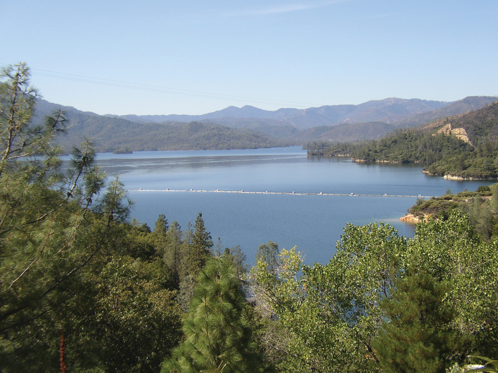
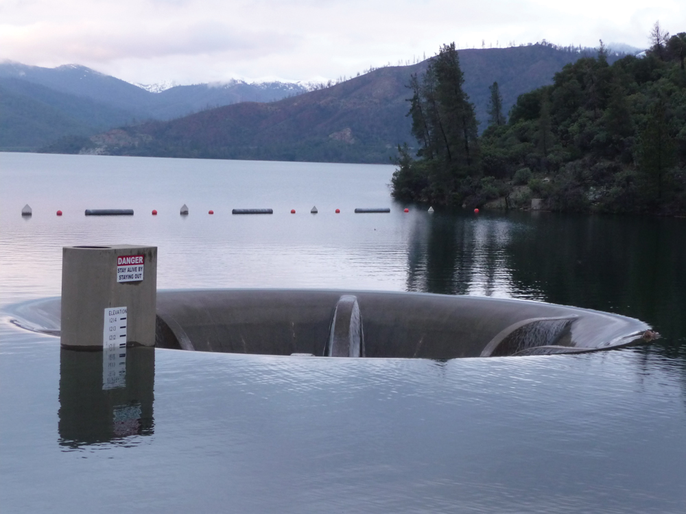
The 241,000 acre-foot Whiskeytown Reservoir was built in the early 1960s and is operated by USBR for power production, water supply delivery to Central Valley Project contractors in the Sacramento Valley, and recreation. As the main hydrologic barrier between Upper and Lower Clear Creek, Whiskeytown Dam controls the timing and magnitude of flows to Lower Clear Creek. Inflow to Whiskeytown Reservoir comes both from Upper Clear Creek (21%) and from water diverted out of the Trinity River Basin via Trinity and Lewiston Lakes (79%). Most of the water stored in Whiskeytown Reservoir is diverted through the Spring Creek Powerhouse and into the Sacramento River. The balance of Whiskeytown water (approximately 13%) makes up the flow of Lower Clear Creek.
With the exception of some minor accretion flows from side tributaries, flows in Lower Clear Creek are controlled by the releases through Whiskeytown Dam. The current release schedule is 50 cfs (January through October) and 100 cfs (November and December).
Water Quality
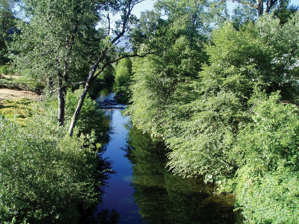
Water quality in Upper Clear Creek is generally good and supports a robust population of native rainbow trout. Willow Creek, a Clear Creek tributary just upstream of Whiskeytown Reservoir, is heavily affected by metals from the Greenhorn Mine, an abandoned copper mine operated in the early 1900s. Monitoring data have not shown significant impact on Clear Creek from the metal-contaminated Willow Creek drainage. Another potential water quality issue is elevated E. coli levels downstream of the community of French Gulch, with the suspected source being individual waste disposal systems.
Both Lower Clear Creek and Whiskeytown Lake are 303(d) listed as impaired waterbodies for mercury. The source of this contamination is assumed to be mercury deposits in the expansive tailings piles that are a legacy of the dredging gold mining operations in the 1800s. Otherwise, water quality in Lower Clear Creek is considered very good and supportive of all aquatic life and recreational uses.
Vegetation
![]()
The dominant vegetation communities in Upper Clear Creek are mixed conifer (43%), mixed hardwood (25%), and grassland (15%). Much of the watershed area is managed for commercial timber production by the USFS, BLM, and private timber companies. In Lower Clear Creek, mixed conifer and hardwood species are prevalent in the higher elevation areas. Below these stands, vegetation is dominated by shrub species such as manzanita and ceanothus, Vegetative communities in the Clear Creek Watershed frequently are modified by wildfire, and this is a constant threat for rural residential development in the Lower Clear Creek Watershed area.
Fish and Wildlife
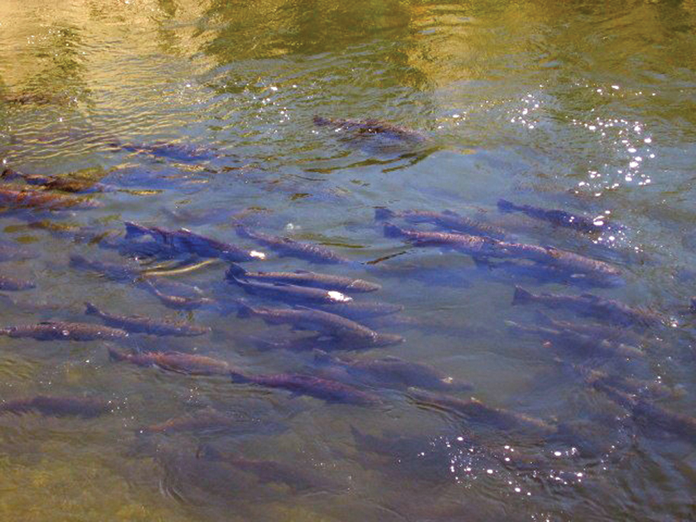
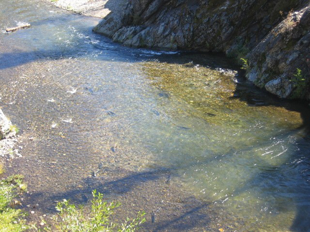
With year-round flow of cold, clean water, Upper Clear Creek and many of its tributaries support good rainbow trout populations. The area provides habitat for a significant resident and migratory blacktail deer herd. Special-status species of note include northern spotted owl, bald eagle, and northern goshawk. In Lower Clear Creek, restoration of salmon and steelhead populations has been a major focus of fishery management agencies for the past 20 years. For the 50-year period from 1954 to 1994, fall-run Chinook salmon populations in Lower Clear Creek averaged around 2,000 fish annually, ranging from around 500 to as many as 10,000 depending on the individual year. In recent years, management efforts have focused on providing adequate instream flow, restoring channel and habitat conditions (gravel augmentation, channel realignment, riparian improvements), and removing impediments to migration. A small irrigation dam (McCormick-Saeltzer Dam) was removed to provide open passage to a significant reach of Lower Clear Creek below Whiskeytown Dam. In addition to the anadromous species, native warmwater species that commonly inhabit Lower Clear Creek include carp and suckers, Sacramento pikeminnow, bluegill, sunfish, and bass.
Life in the Watershed
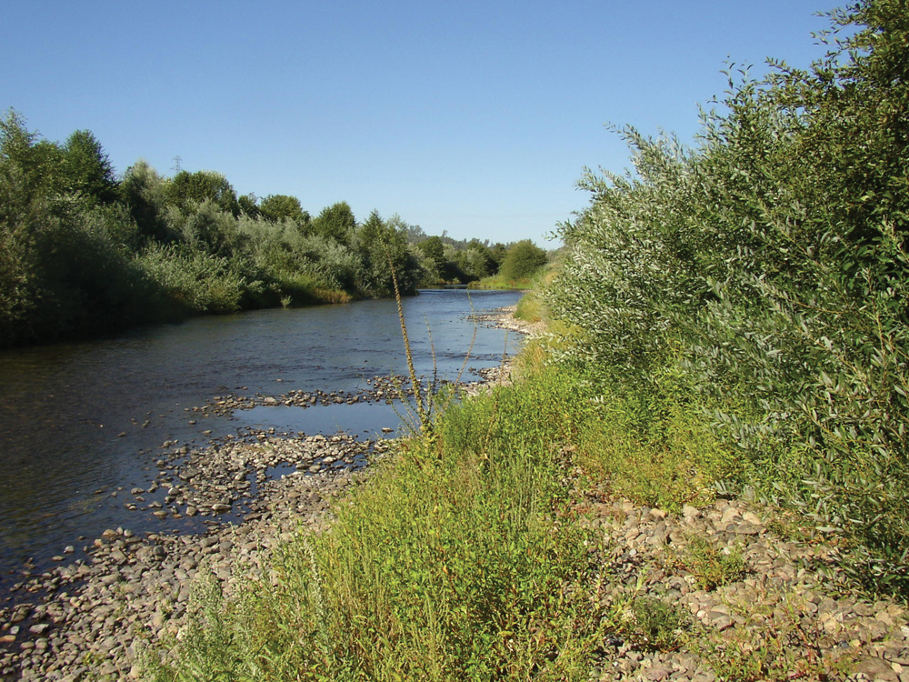
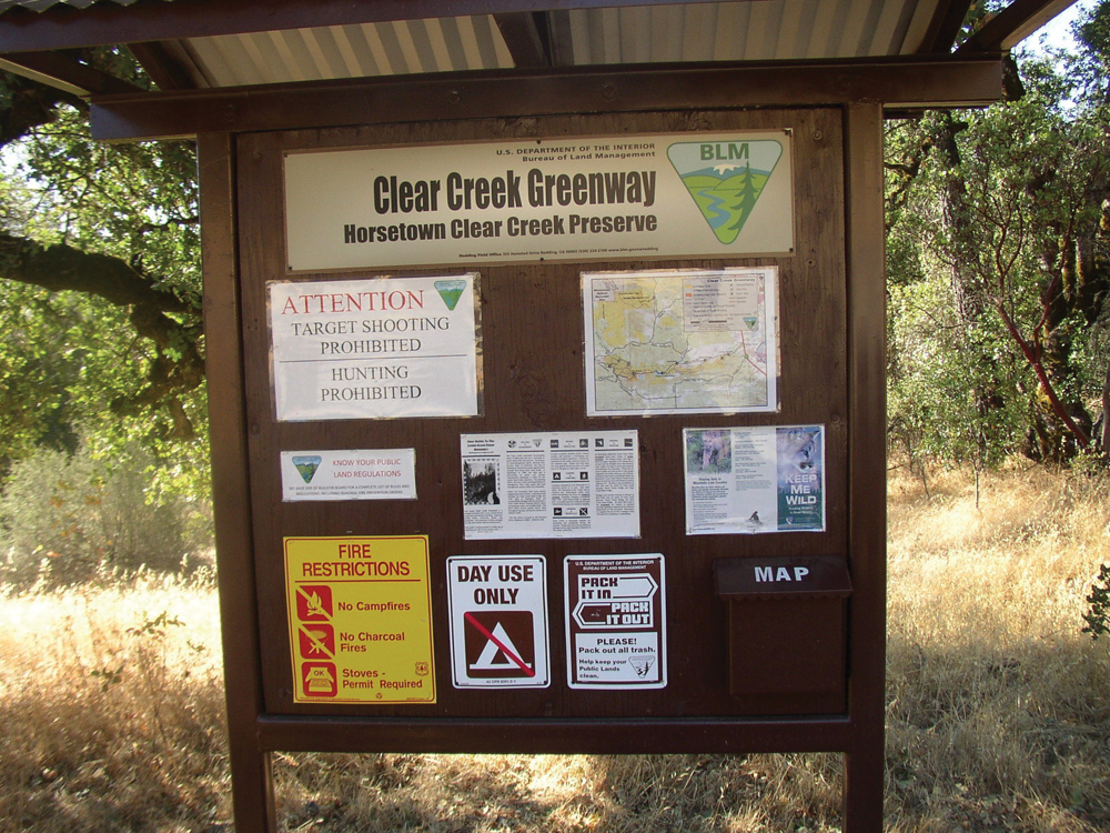
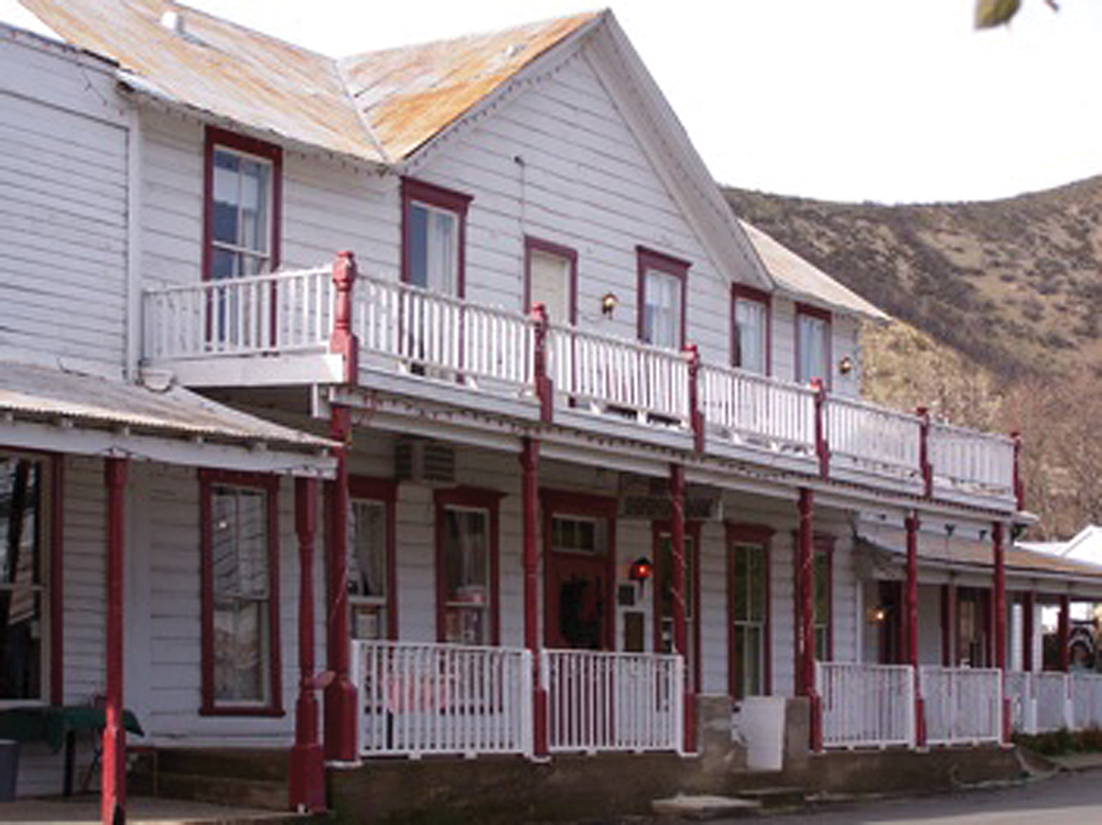
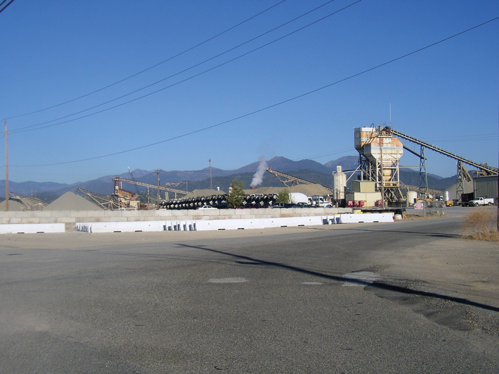
Land use in Upper Clear Creek includes residential, recreation, commercial timber production, and mining. Historically, placer and tunnel gold mining was prevalent, reaching its peak from 1900 to 1915, and some of the mines are still being operated. The historic mining town of French Gulch (population 650) is now a center for rural residential development and tourism. This is a popular recreational area for activities such as camping, fishing, boating, hunting, and nature study. Lower Clear Creek is in part within the city limits of Redding. Industrial (sand and gravel) and commercial enterprises (lumber mills, electrical generation, and auto shops) exist along Clear Creek Road, which runs adjacent to much of the Lower Clear Creek stream zone. In recent years, the BLM has attempted to acquire and manage much of the land area along Clear Creek, and there is now a public access greenway virtually all the way from the Whiskeytown Dam to the Sacramento River (a distance of approximately 9 miles). Swimming, hiking, fishing, gold panning, and kayaking are popular in this public land area. Clear Creek near the Sacramento River confluence is a densely populated area, and the Redding municipal wastewater treatment plant is located here, with discharge to the Sacramento River.

Management Objectives
Under the direction and leadership of the Western Shasta RCD, the Upper Clear Creek Watershed Group, and the Lower Clear Creek CRMP, watershed assessments and management plans have been completed that include the following objectives.
Upper Clear Creek:
- reduce forest fuel loads and the risk of catastrophic wildfire;
- address water quality concerns, particularly with regard to erosion and drainage from abandoned mines; and
- manage dispersed recreation and land development to avoid adverse impacts on the ecosystem.
Lower Clear Creek:
- restore fall-run Chinook salmon, spring-run Chinook salmon, and steelhead to achieve maximum production capacity within this watershed;
- through land acquisition and management, establish opportunity for a variety of public recreation on lands adjacent to Clear Creek from Whiskeytown Dam downstream to the Sacramento River;
- establish Lower Clear Creek as a center for youth and adult outdoor education with a focus on restoration and watershed stewardship; and
- manage upland areas to reduce fuel loads and fire risk, reduce erosion and sediment discharge, and enhance wildlife habitat.
- Organizations Active in the Watershed
Western Shasta Resource Conservation District
Western Shasta RCD has been the leading organization in promoting fishery restoration, fuels reduction, erosion control, and public education in the Clear Creek Watershed. The RCD was instrumental in completion of the Lower Clear Creek Watershed Analysis (1996), the Lower Clear Creek Watershed Management Plan (1998), and the more recently completed the Lower Clear Creek Floodway Restoration Project, which includes channel and habitat improvements, wetland and riparian enhancements, and public hiking and picnicking facilities. Western Shasta RCD coordinates and provides technical services to the Lower Clear Creek CRM group and the Upper Clear Creek Resource Management Group.
Bureau of Land Management
BLM has acquired a number of private land parcels along Lower Clear Creek and has established a greenway for public access through most of the stream corridor from Whiskeytown Dam to the Sacramento River.
![]()
![]()
![]()
![]()
![]()